dugidugi
A mobile app for checking high-risk areas using information on people infected with COVID-19

Introducing dugidugi
The dugidugi app was built in response to the COVID-19 situation at the time. Developed with React Native, it supports both iOS and Android.
Anytime, anywhere, the dugidugi app retrieves data on confirmed COVID-19 cases nearby, shows it to users, and informs them of the cases’ travel routes, so it is expected to reduce the likelihood of infection.
Screens
1. dugidugi main screen
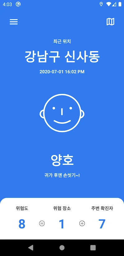
As shown here, the main screen presents accurate data and a risk score calculated for the current location, expressed clearly with colors and icons.
It also lets users view confirmed-case information for their current location, or switch to the map to see all confirmed cases at a glance.
2. Risk level explanation screen
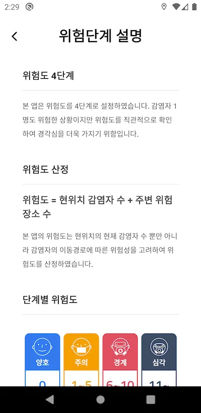
We divided risk into levels to avoid confusing users.
As shown above, risk scoring uses a single fixed formula to calculate and display the risk score.
All confirmed-case data comes from local government websites.
3. Notification settings
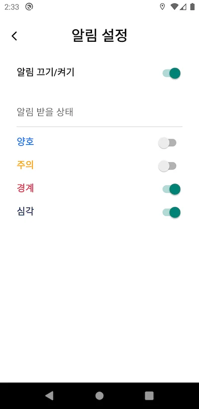
The dugidugi app uses push notifications to help users become aware of high-risk areas. Even when the app is not in use, it automatically sends a push notification when users enter an area at a risk level they have selected.
4. Map screen
The map shows nearby places visited by confirmed cases.
It also provides information on how many confirmed cases have visited and how many high-risk places there are.
Zooming in and tapping a pin shows detailed information about that place.
5. Confirmed-case travel route screen
Users can view confirmed-case information in one place.
For each confirmed case, users can check which areas that person visited.